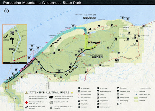
Week 15: Crabtree Meadow to Muir Pass
Day 101 ( July 10 ) Heading to the Pass
We left Crabtree Meadow at 8:30 and leapfrogged the Gang of 4 at the Tyndall Ranger Station. We continued to hike up to the Base of Forester Pass which is the highest point on the PCT at 13,120 feet. Along the way we went through Bighorn Plateau, another misnamed place. We didn't see a single Bighorn Sheep only a Mule Deer.

We camped at the base of the pass and had a funny conversation about Flat Earth Theory and how crazy kids can be.

Day 102: To the top of the first Pass
The Gang of 4 passed us at 6:30 on their way up Forester Pass. We started up the pass at 8 AM
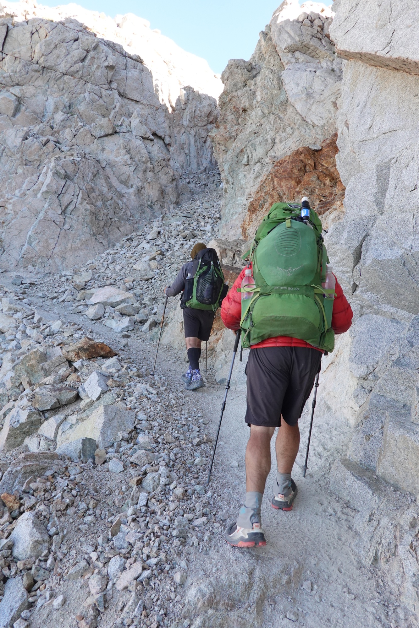
and reached the top at 9.

Forester is a beautiful pass. The trail is fairly smooth and easy to hike on both sides. The views are good and it's not that hard a hike ( at least without snow on the ground).

We were surprised to see that two people had actually camped ABOVE the pass.

A SoBo hiker told me that the blue flowers at the top were Pilot Flowers

and that there was a clump of white Pilot Flowers down the slope.

On our way down the North side of the pass, we passed about 20 hikers going up the pass. As we got to lower elevation, the trail followed a stream, meaning water was not an issue. Unfortunately the abundance of water resulted in an abundance of mosquitoes. There wasn't a single adult mosquito: They're all married and have HUGE extended families.
Doug was getting a little irritated towards the end. It seems there was a slight misunderstanding in how much further we had to go and how much higher we had to climb.

Blaine and I both worried that he was overheating as his face was a dark red. After a good meal and some water, he was OK. As we sat around talking, we watched a Male Western Tanager flying back and forth feeding it's young. As the sun started to set, a Hermit Thrush sang us a lullaby. Sarah from Vancouver, BC might join us tomorrow. She wants to get to Lone Pine to pick up a package. Hopefully, Blaine can get his car so we don't have try to hitch everywhere.
On a separate note: I need a different pack. The one I bought in Julian back in April is now to big for me. When I buckle the hipbelt on my hips, there is more than an inch of space between my shoulders and the shoulder straps. I will ask Karen to ship my PCT 55 pack to me.
Day 103: Doug and Blaine's last day on trail.

We left camp with Sarah at 8 AM and hiked out to Kearsarge Pass via the Bullfrog Lake Trail.
 |
| Blaine, Doug and Sarah |
Bullfrog Lake is another ( apparently ) misnamed place, because when we hiked past it, we didn't see or hear a single Bullfrog.

We reached the top of Kearsarge Pass


at 10 AM and descended to the Trailhead arriving at 12:30. Sarah and Blaine got a ride to Lone Pine at 1 PM.

Doug and I were able to get a ride to Lone Pine at 3.
When we got to Lone Pine, Doug and I browsed around while we waited for Blaine to arrive with his car ( his car was parked at Grumpy Bear's Resort 50 miles from Lone Pine). Doug managed to get a motel room for us in spite of the event that was going on. If you think I am crazy for doing a through hike, the "event" was the "Badwater 135", a non stop run from Death Valley to Mt. Whitney. Did I mention that these people were RUNNING in 105 degree heat ?
Blaine finally arrived and we picked up Sarah who seemed a little "out of it", probably because of the heat. We went to the Motel and showered. Then I treated everyone to dinner. Don't ask the cost, because I don't even want to think about it. We then got some stuff from the grocery store ( Sarah treated everyone ) and returned to the motel to chat and listen to two songs that Doug had written. Not Bad !! Doug and Sarah shared one bed ( GET YOUR MIND OUT OF THE GUTTER !! ), he slept above the sheets, she slept below the sheets. For some reason, everyone decided I should sleep alone in the other bed ( is my snoring really that bad ?? ). Blaine opted to sleep on the floor. For some reason, I didn't sleep well.
Day 104: Farewell Good Knights, back on trail
I went and did laundry at 06:45. When I returned we packed up. As we were packing, Doug asked Sarah what her trail name was. Evidently someone decided to call her "Black Hole" because her pack is black inside and out and she has a hard time finding things in her pack ( Note to Zpacks: make the insides of your packs white so people can find the stuff they're looking for ). I decided that wasn't nice, after all they didn't call Cheryl Strayed (author of "Wild") " Monster", so when I saw her grab all the sugar packets, I suggested a new name. Hummingbird.
Once we were packed, Blaine drove us to Bishop, where Sarah treated us to breakfast at Erick Schat's Bakery.
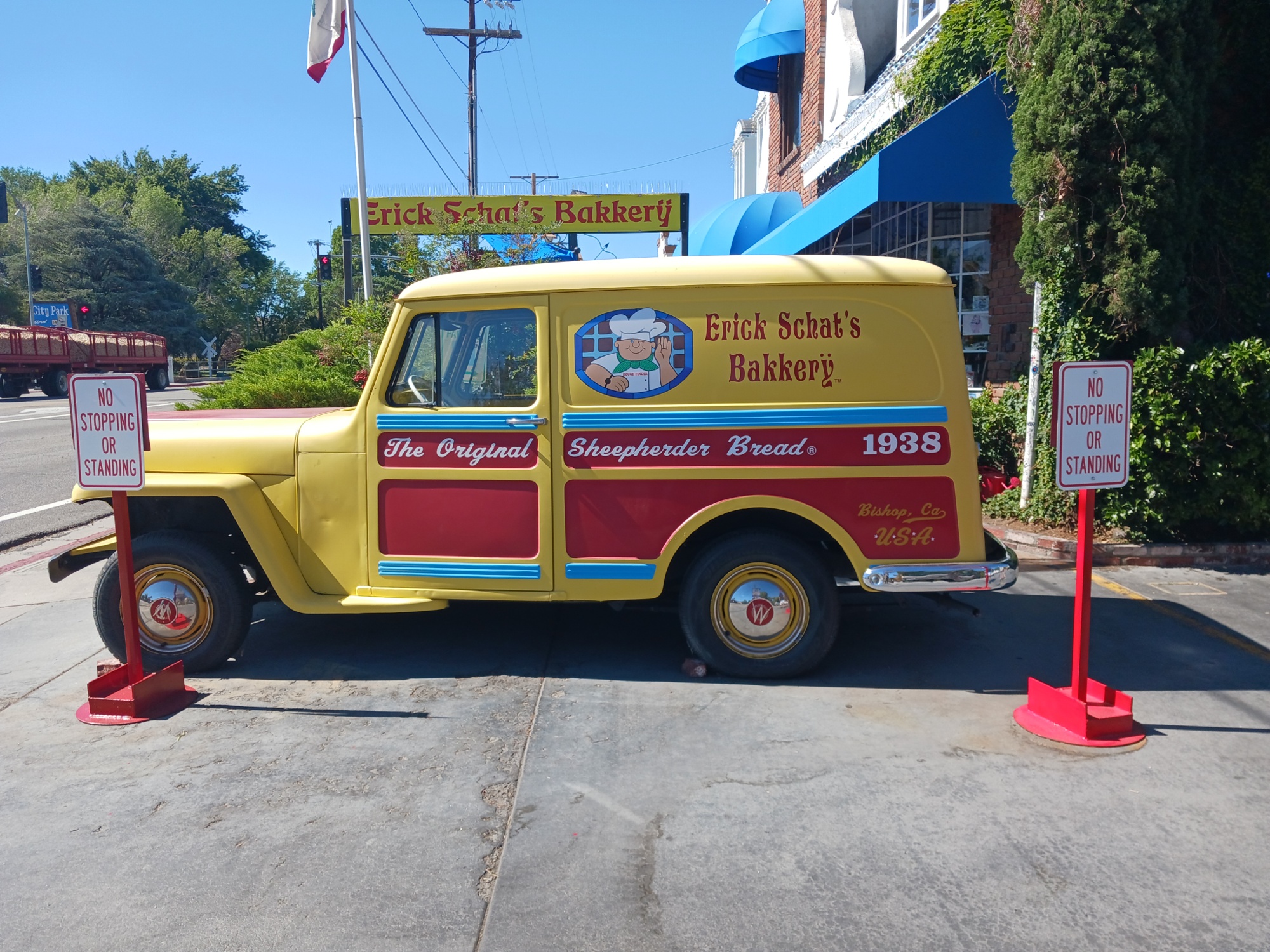
Evidently it's world famous, and the line out the door and the excellent food

leads me to believe it's true.
 |
| Sarah is an EMT. She's helping a diabetic customer with a blood sugar spike. |
After breakfast, Sarah and I shopped for gear. Sarah got a sun hat and I bought a new sleep shirt and new shoes. Then it was time to resupply. Blaine and Doug drove us to the trailhead,

where I spent an hour trying ( and failing ) to fit 7 days of food into a Bear Cannister. Doug gave me a Bear hanging kit to store the excess. Fare thee well Sir Knights. It was an Honor, a Privilege and a Pleasure to hike with you.
Sarah and I started hiking at 2:30. Sarah sets a good pace, but we stopped a few times for photos.

I had a close call. As we were hiking up the pass, a train of two packhorses was coming down the pass.

Without thinking about it, I stepped off the trail on the downhill side. One of the horses bumped into me and I nearly lost my balance. I wasn't on a cliff, but a backwards tumble would have been very painful to say the least. We finally topped Kearsarge Pass at 6 PM.
 |
| Sarah at the top of Kearsarge Pass |
Not bad for a 5 mile, 2000 foot climb.
Kearsarge Pass is located in the Alabama Hills.
 |
| Doug pointing to the Alabama Hills from Lone Pine |
If you are wondering why there are Alabama Hills in California, it has to do with the US Civil War. In 1863, a Confederate Commerce raider, the CSS Alabama was sunk in battle. When some miners in the area with Confederate leanings heard about its loss, they named the hills they were mining in its honor. Not to be outdone, the local Union loyalists named the only pass through the "hills" in honor of the ship that sank the Alabama, the USS Kearsarge.
We started down the PCT side of Kearsarge Pass and took a different trail than the one we took yesterday. Along the way we stopped for more photos,

including staged shots of each of us "hanging" over the edge.


We reached our campsite about 1 mile from Glen Pass at 8 PM.

At 9:45 I heard what sounded like a rockslide coming from the direction of Glen Pass. Hopefully the trail isn't blocked.
Day 105: Glen Pass sucks loose rocks
Today was the classic HDL ( Harder, more Difficult, everything takes Longer ) day.

We were up and moving by 6:30.

Unfortunately we didn't have any water, because the stream we were planning on camping near last night was dry. So we had to make do with breakfast bars. We were able to get water from a stream at 7 AM and made it to the top of Glen passs at 8 AM.

Me at the top of Glen Pass with
 |
| Do you see the trail down the pass ? |
The trail down the pass was steep and full of shifting rocks and sand which made the descent long and tiring. We finally made it to Rae Lakes ( named for Rachel "Rae" Colby the wife of a conservationist ) at 9:45 and took a well deserved break.
 |
| Sarah sitting down at the shore of Rae Lake for a well deserved break. |
After our break,we resumed our hike. At 12:45 we saw my first bears of the hike, a sow with a cub. Mom was Cinnamon Brown and the cub was black. We were safely on one side of a creek and they stayed 200 feet away on the other side.

At 2:45 we reached the Suspension Bridge at Woods Creek ( mile 799.8 ). Let me tell you that bridge is creepy.

The sign says "One person at a time" and it's scary enough with just one. It sways and bounces up and down. What's even scarier is the bridge had been closed for 10 days because one of the bridge plates had detached from the cables. GULP !
After crossing the bridge and resting, we started up the slope towards Pinchot Pass (named after the first Director of the US Forest Service ), crossing the ( unmarked ) 800 mile mark along the way. We were hoping to get to mile 805.9, which would put us 1.2 miles from the pass. We stopped at mile 802.6 because we were worried it was going to rain and because Sarah had hiked me into the ground.
 |
| It doesn't look like it, but it says 800. |
Remind me to never judge how fast she is hiking. I made the mistake of telling her we probably wouldn't make our destination and she proceeded to fast hike me into the ground.
There were several people in camp, including a person Sarah had hiked with before. I thought for sure we were going to split up, especially when she said she had found the perfect hiking partner for me, a man who hikes 10 to 12 miles a day. Then she asked what time WE were leaving. WHAT ?? When I asked her why she was asking me (assuming she was going to hike with her friend) she asked if we were still friends. Cool !! We are going for a 5 AM departure. We have 4.1 mile, 2500 foot climb to the pass. My concern is the 10 percent chance of heavy rain tomorrow afternoon.
OOPS !! Everyone got to hear my Classical Playlist because I didn't push the headphone jack in all the way.
Day 106: Pinchot Pass good, Mather Pass bad
Got up at 4:30 and we were on trail at 6. We made the summit of Pinchot Pass at 9AM.


When I made the comment that we should be able to get over Mather Pass ( about 10 miles away ), Sarah said that we better. She then told me she was going for 15 mile days and if I couldn't keep up, she would leave me behind. The next time I stopped for a photo, she kept hiking. I decided ( paraphrasing a line from Huey Lewis and the News ) I'm not here for a long hike. I'm here for a good hike. So I will take my time and hike at a comfortable pace. I will stop and smell ( and photograph) the flowers when I feel like it.


In spite of my relaxed pace, I managed to get over Mather Pass ( mile 816.9 ) by 4:30.

Mather Pass is very similar to Glen Pass, lots of shifting rocks ( I wonder if both passes aren't named after some dude who's name was Glen Mather ).

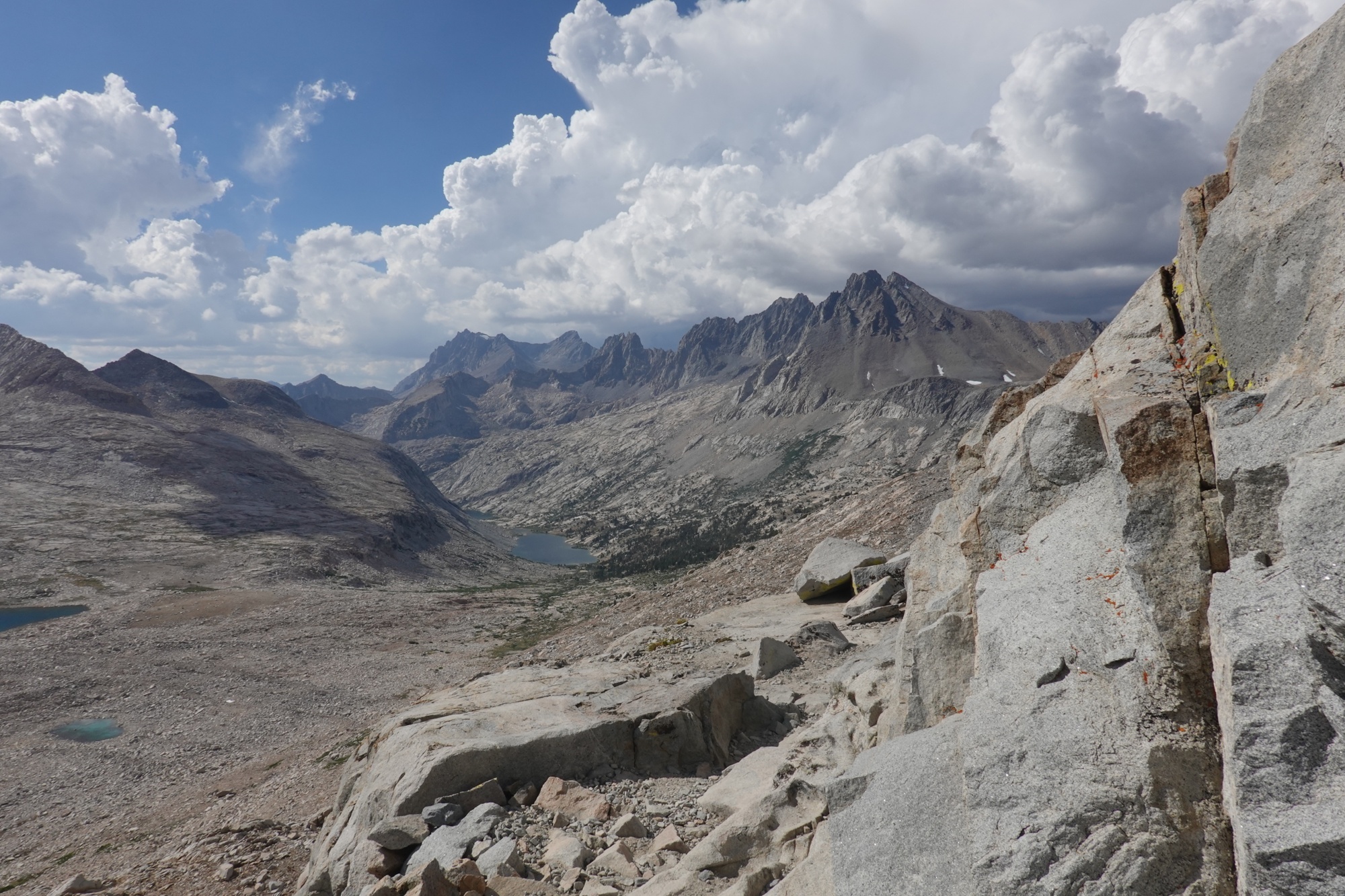
On my way down the north side of Mather Pass I stopped at a stream ( more like a miniature waterfall )

to refill my water bottles and take some photos.

As I was filtering some water, Sarah's friend Sven came up behind me and told me there was a Wolf uphill from me. I was able to take a quick glance and recognize the animal as a Coyote. I wish Sven had told me sooner. As I continued down the trail I managed to wet my pants...... by slipping and falling into a stream. My new life bird is Gray crowned Rosy Finch.
Day 107: Rain on the Mountains
I slept in and didn't start hiking until 6:30.

I took my time because I was taking lots of photos during the morning.


I picked up the pace in the afternoon because the light was bad. I took some photos of Dusy Branch ( named for a Rancher who worked and photographed the area in the 1870s ).

Later in the afternoon, the sky started to darken. At about 4 PM I made it to the campsite at mile 832.4 before it started to rain.

Here's a clue about Sierra mountain weather: if it's at least partly sunny in the direction you are traveling, keep going. If the sky is dark gray in every direction seek shelter or move to a lower elevation.

When I got to the campsite, Brett (aka "Dirty Water" ) was sitting under a tarp he had strung between two trees. Someone had kicked a big hole in the rain fly ( the part that obviously keeps the rain out of your tent ), so he couldn't set up his tent. Until his tent is fixed ( 4 to 6 weeks ) or he can get a new one, he uses the ground cloth of his tent as a tarp when it rains. He said that he heard that the next 5 days or so were supposed to be "Monsoon" weather, with lots of afternoon rain.
It started to rain hard at 4:10 ( just as I finished getting my tent up ) and continued to rain hard until about 4:30. At 4:25 Brett told me that a SoBo hiker had just run down the trail. At 4:30 a NoBo hiker passed us in the rain. The rain finally stopped around 5 and a Mule Deer doe passed through camp.

She wasn't afraid of us, but she wasn't willing to pose for photos either. At 5:30 I went and got water from a stream 0.3 miles up the trail. On my way back to camp, I passed Brett heading up the trail.
Comments
Post a Comment