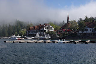
Week 19: South Lake Tahoe, CA - Cascade Locks, OR
Day 133 ( August 11 ): A hop, a skip & a jump
So much for reliable websites... My plan called for hiking to the State Line Transit Center, boarding a bus to Reno, getting on my flight to Redmond ( Oregon not Washington where Microsoft is.

Don't feel bad, I didn't know there was a Redmond, OR either ) and then getting on a Bus to Bend ( Bus to Bend almost sounds like the name of a Rock band doesn't it ? ). Well my plan fell apart immediately ( thank God I got a very early start ). I turned out the only bus to Reno had just left before I got there ( so much for the websites schedule showing a bus every 30 minutes or so ).
So I tried Lyft. After spending 10 minutes persuading ( with some "colorful metaphors" muttered under my breath ) their website to work. I was able to hire a ride. William showed up EXACTLY 1 minute after I requested my ride. For $135 I had a good conversation and a pleasant ride to the airport. William dropped me off early enough that I was able to grab a quick bite to eat. Turns out the airline considers a backpack too big to go in an overhead bin, so I had to check it ( and pay another $30. Now you know why I don't like flying. I swear the whole industry is either ruled or influenced by the mob ).
The incoming flight was late, so we didn't start boarding until our scheduled departure time of 12:25. The plane layout is unusual. My seat is both a window seat and an aisle seat.

We finally took off about 1 PM. The flight out of Reno was so bumpy, I couldn't look out the window (before you call me a total wuss, remember, I've hiked over passes higher than 13,000 feet). I found out later from another passenger, that flights in and out of Reno are always bumpy because the airport is surrounded by mountains. Once we got to cruising altitude the flight was fairly smooth. The descent into Redmond was a little bumpy but the landing was smooth as silk.
For the first time in my life, I actually had to walk down the steps to the runway and then follow a path of safety Cones into the terminal.

I quickly grabbed my pack ( I only had to wait a minute or two in baggage) and went outside to get a ride to Bend. The shuttle driver charges a flat rate based on the distance from the airport and he showed me his chart so at least he's not gouging me. He even dropped me off at the REI store.
One of the logistical challenges of the PCT are the shortage of stores to buy hiking equipment. There are only 4 stores on the PCT where you can buy major hiking gear ( tents, backpacks, etc... ) and the last one as you go NoBo is the REI in Bend. I was hoping to get a pack that fits me and can hold all my gear. The folks at the Bend REI could definitely use the Kyle Hockley Customer Service 101 course ( for those of you who aren't co-workers, Kyle is my boss ). I was wandering around the store for about 15 minutes before anyone even said hi. Pairs of employees walked past me, talking to each other as if I wasn't there. Unfortunately, they didn't have a pack I liked but I did get pants that fit me ( Hey ! You lose 40 pounds in two months and see how well your clothes fit. )
I did get one bit of luck though. I looked at the cost of a room and when I saw it was $75 for a bunk in a hostel, I decided to skip town. I contacted a shuttle driver at 6PM ( figuring he would pick me up in the morning ) and was dropped off near where the PCT crosses Highway 242. I then road hiked 0.3 miles to a campsite and called it a day.
Day 134: I hate hiking on Lava !
I woke up at 6 and walked back to where I was dropped off last night. I was dropped off at the Dee Wright Observatory which was built in the 1930s.
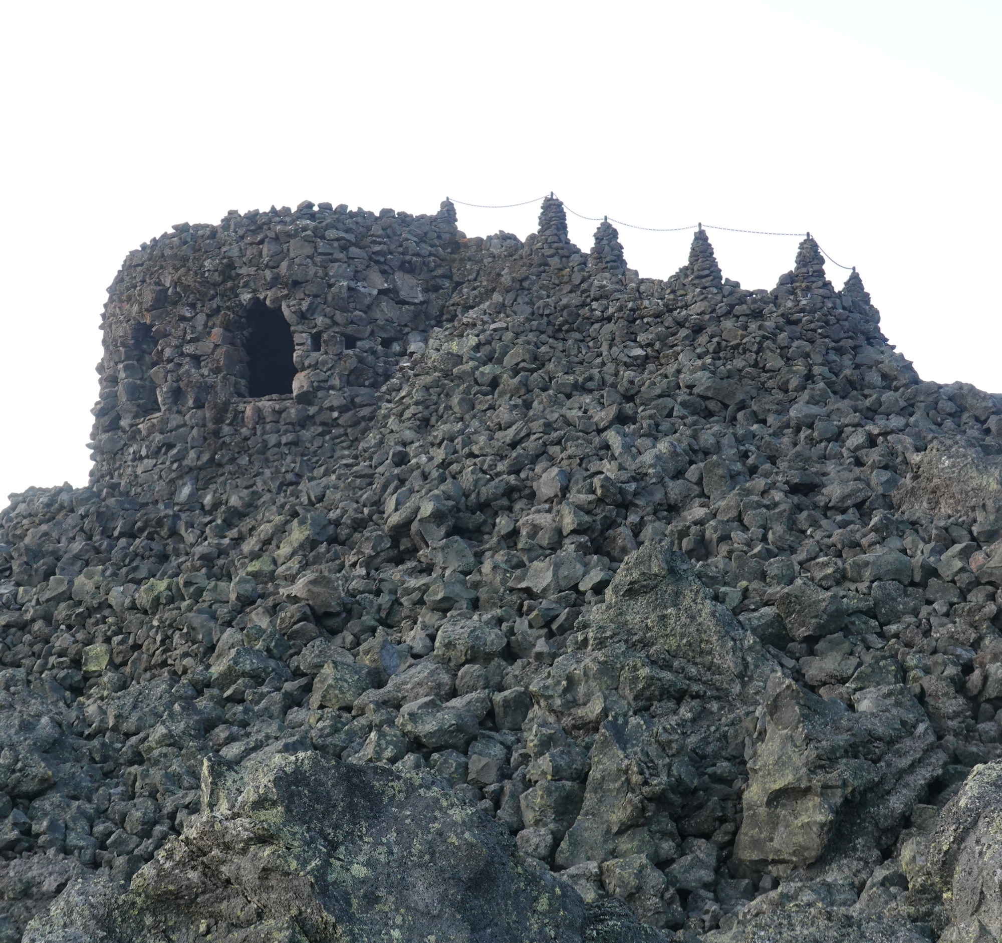
From the Observatory you have a 360 degree view of the area including the distant mountains and the nearby ( $$#@!@@* ) lavafield that I would soon be hiking through.

I spent an hour or so walking the discovery trail and taking photos, before returning to camp and packing up.


I started hiking at 8:30 and spent the next 3.5 hours muttering certain words under my breath as I hiked through 5 miles of lava field. For those of you who have never hiked on lava rock ( you might want to add that to the list of "Things you are thankful for" come Thanksgiving ), imagine walking on a sandy beach. Now imagine that all the grains of sand have different sizes and shapes ( usually with a rough edge pointing up for you to step on ). Oh, and make them black so they will pull the sunlight towards you making it hotter than it already is (and trust me, it's already hot enough). The interesting part was the side trail into Little Belknap Crater ( how often do you get to hike a volcanic crater ? ).
 |
| A lava tube in Little Belknap Crater |
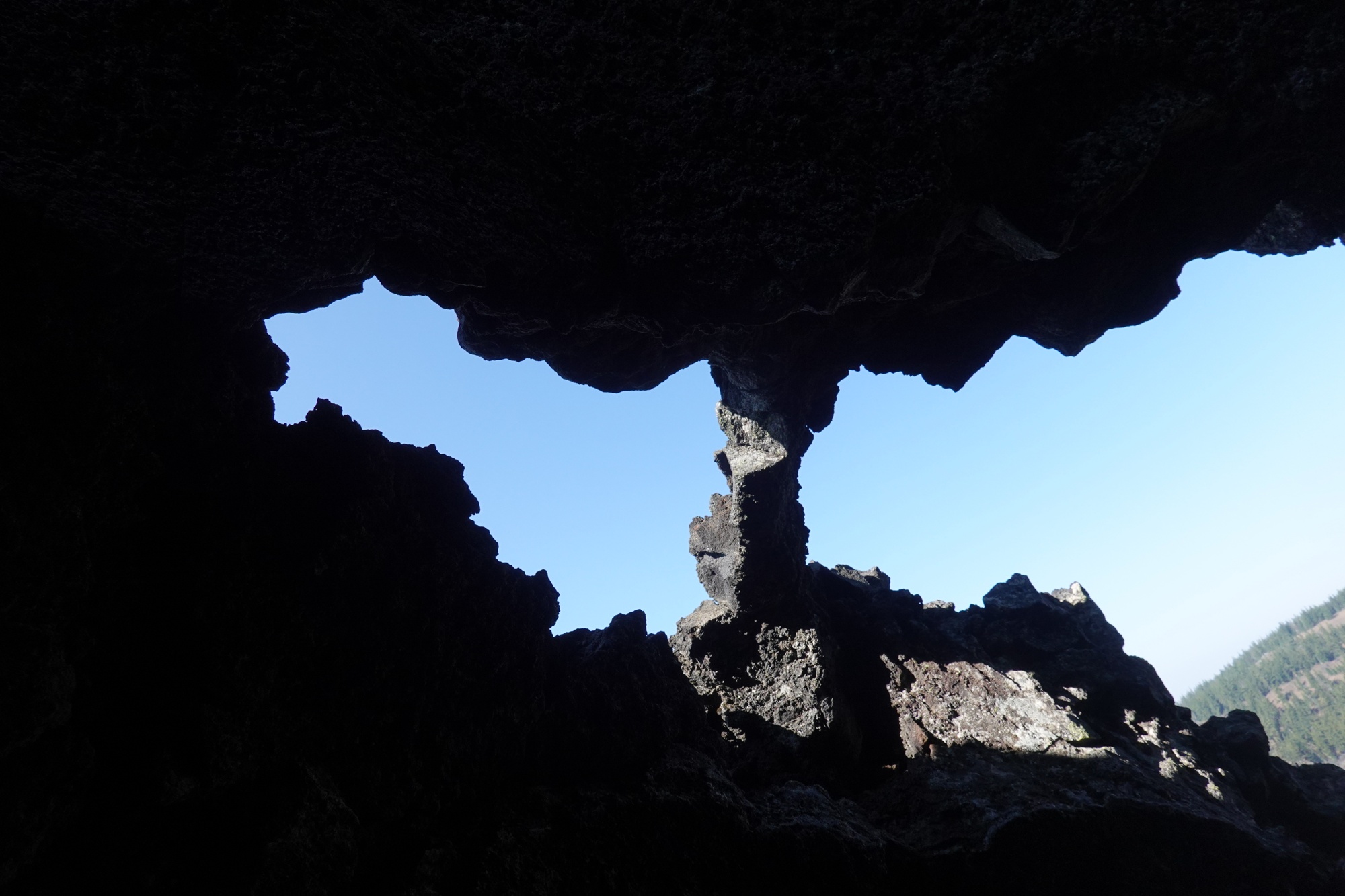 |
| Looking out from a lava tube |
Just north of the lava field is a large swath of forest that burned several years ago and still hasn't grown back. I'm not sure the the forest will ever come back. Climate change is hammering the mountain forests with a deadly one - two punch. First, the climate is getting hotter and drier. This means the trees aren't getting enough water. It also means that when (not if, WHEN) fires occur, they burn hotter and longer because there is more dead vegetation on the ground. Second, the Asian Pine Beetle is moving into the area, killing Pine trees as it does. To make it worse, because of Climate change, the winters are getting milder. This means that the Asian Pine Beetle is able to move further North and further up the slopes. Enjoy your views of the Pine forested mountains while you can, because they are an endangered species.


At 1:45 I made it to Big Lake Youth Camp. Big Lake has a tradition of giving meals to passing hikers. A few years back, a passing hiker donated enough money for the camp to build a "Hiker Hangout" complete with Wi-Fi, charging ports, showers and Laundry.

I had heard that the meals were good ( which is why I took the 2 mile detour ), but today was the last day of camp, so all we got were brown bag meals. I stayed until 6:45 and charged all my electronics. I finally made it to camp at 7:45.
Day 135: The Longest, Cheapest Hitch ever
I had to hustle this morning, or at least I thought I did. 2 miles North of me, the trail is closed because of a fire from 2 years ago.

No, it's not burning, but the Forest Service wants to make sure it's safe before letting people hike through there. So that means I have to get a ride around 40 plus miles of trail that are closed. Good thing I got in touch with Devilfish. Devilfish is a former Government Contractor who shuttles hikers around the fire closures.
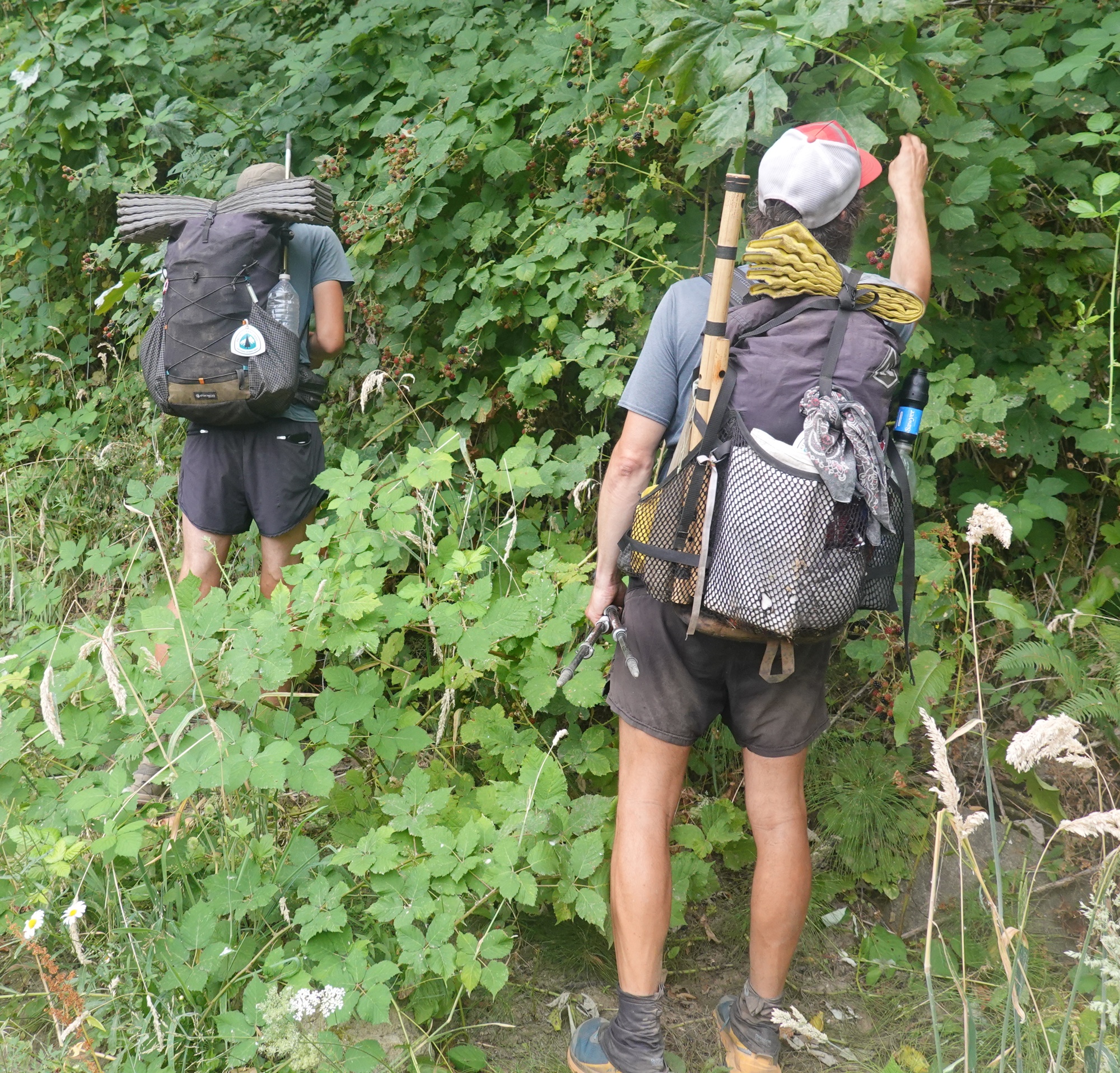
I hustled to where the trail crosses US 20 and made it there by 7 when I thought he would pick me up. Then I checked his text. Pick up isn't until 9 ! Oh well better two hours early than 10 minutes late. At 9, Devilfish picked me up. He drives an Extended Cab pickup truck with a cap on the back. When he picked me up, he already had 4 hikers in the front, so I joined the 3 hikers in the back.

 |
| The stack of packs in the back of the truck |
First, we drove 15 miles to the town of Sisters, where two of the hikers in the back got out. Then Devilfish drove about another 25 miles to Bend so he could pick up two more hikers and a third hiker could get a package from the Post Office. We then stopped at McDonald's ( my first McDonald's since March 25th) to get lunch. He then dropped off the two women that joined us in Bend at the Frog Lake Trailhead (mile 2087.5) because they had reservations at Timberline Lodge. He dropped the rest of us off at Olallie Lake ( near mile 247 ) at the North end of the trail closure.

We figure he drove 150 miles in a large pickup and refused to accept any donations. Finally I asked if I could buy him a Coke which he accepted. When I suggested that his trailname should be changed to Angelfish, he explained that "Devilfish" was mariner slang for Gray Whale which is his favorite animal.

Before hiking on, I took a couple photos of Mt Jefferson looming over Olallie Lake.


Later, I took some photos of Jude Lake.
 |
| Hey Jude ! Don't be sad, you've got a Lake! |
Made it to camp at 7.
 |
| Someone lost their lunch.... |
I covered 10 miles in 3.5 hours. Not bad !! I could have gone further ( I reached camp at about 6:45 ), but if I had, I would have wound up on the Warm Springs Indian Reservation.
Day 136: The OTHER Crater Lake
I got going at 7 and started hiking.

Within 200 feet I crossed into the Warm Springs Reservation ( which is why I camped where I did last night ). There are some rules for hiking on the Rez.
1. No Hunting
2. No Camping
Oh, and Gandalf says DON'T LEAVE THE TRAIL !
Seriously, you are not allowed to go more than 200 feet from the trail.

In other words, if you need to "Go # 2", you better hold it until you are off the Rez. I hiked to Clackamas Lake (mile 2073.6) a total of14.7 miles by 1:30 having left the Rez about 1 mile back.

I rested for an hour ( picnic tables are wonderful things to lie on when you want to rest sore muscles ) and then continued to Little Crater Lake. Little Crater Lake is a small ( really it would be a pond if it wasn't so deep ) Lake that is almost Cobalt blue in color an about 50 deep.


https://en.m.wikipedia.org/wiki/Little_Crater_Lake. ,I was thinking of camping at the nearby campsite, but $25 to pitch a tent is a bit much, so I camped where the Little Crater Lake Trail joins the PCT. MY PACK IS KILLING ME !!
Day 137: Timberline Lodge
I was up and moving by 6:45. I hoped to make it to Timberline Lodge in time for lunch. I made good time initially as I was pushing hard ( the Lunch Buffet at the Lodge has a good reputation with hikers )
 |
| Sometimes the trail is good like this....Sometimes |
. At 11:40 I reached the Barlow Road Trailhead (mile 2092.5 ) where a woman named Michelle was doing Trail Magic. I got an Orange Juice, some cookies, grapes and strawberries before moving on. It took me another 2.5 hours to hike the remaining 5 miles or so to the lodge.

 |
| I hope this isn't true... |
When I got there I was totally exhausted. I had originally planned on stopping at the lodge for a bite to eat and then pushing on. Instead, I was so tired, I rented a room (don't ask the cost. You really don't want to know and I don't want to tell) and had dinner in the dinning room.

To give you an idea of how popular the buffet is, when I asked if I could make a reservation for the breakfast buffet, I was told that it was booked solid.
Day 138: Ramona Falls
I slept in until 7, showered, dressed (why do men get DRESSED ? I don't wear a dress !) and went down for breakfast.

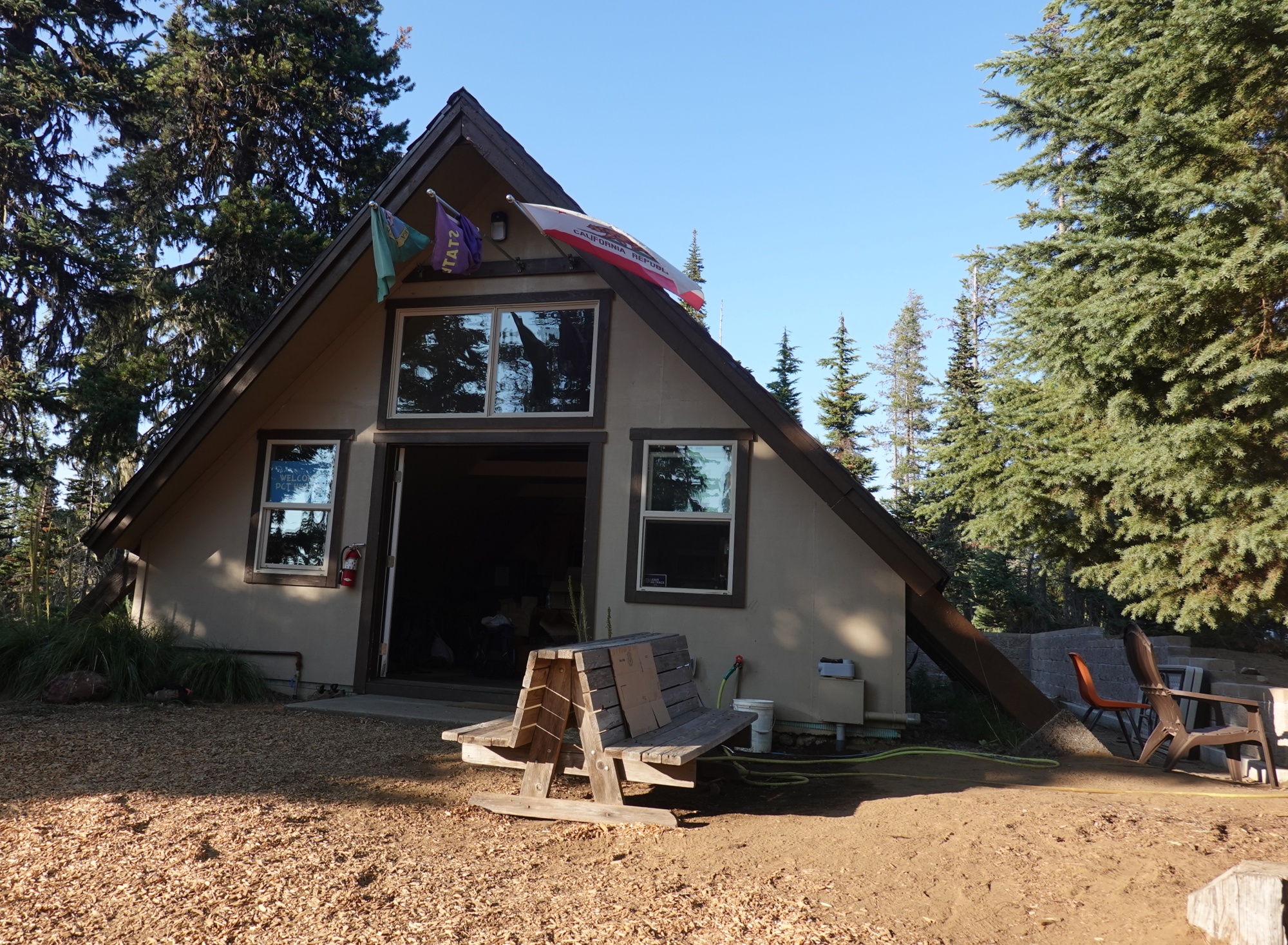
Lucky for me, I was able to join a group of fellow hikers. The buffet us well worth the $25 and I highly recommend it if you are ever in the area. After breakfast, I walked about taking photos. The lodge was built in 1936 - 1937 and was dedicated by FDR in 1937.


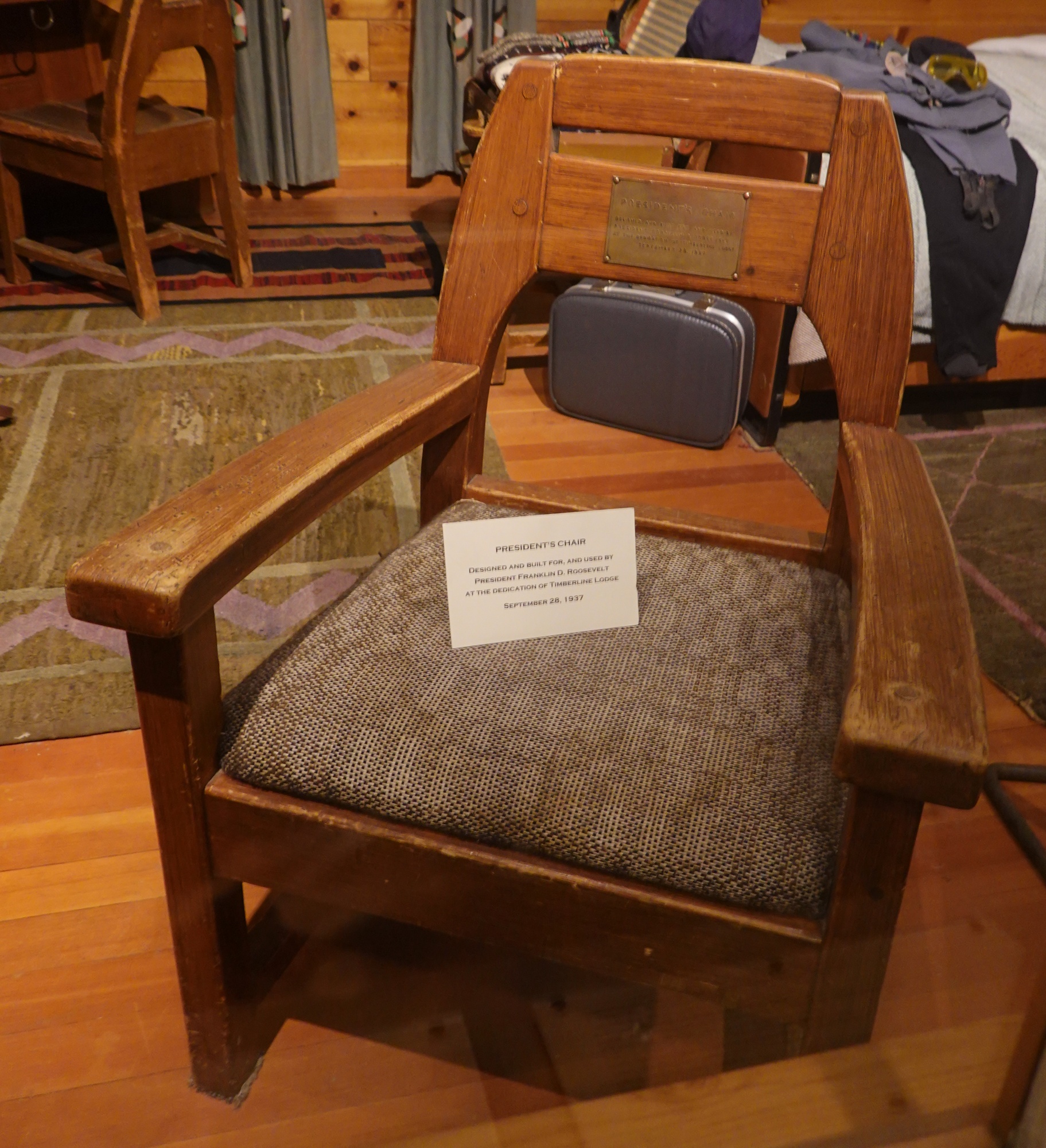 |
| FDR sat here........Once |


 |
| Yes you can go snowboarding in AUGUST at Timberline Lodge... |
In the 1950's there were a few movies filmed there.
I started hiking at 10:45 and was able to hike almost 16 miles by 6:30. What helped was that it was more downhill than up, but a lot of the uphill sections were fairly steep, especially after a stream crossing.
 |
| Making a tricky stream crossing |
 |
| SUCCESS!! No wet feet here ! |
 |
| A waterfall below Mt Hood |
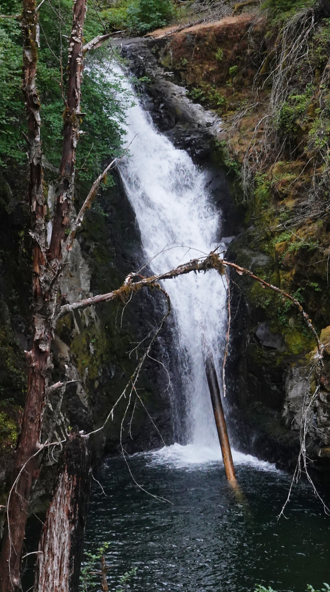
The highlight of the day was the 1 mile sidetrip to Ramona Falls, so far the best falls I have seen on the PCT.
 |
| Sorry for the mid day lighting |
 |
| This is just part of Ramona Falls |
I must point out that I probably bypassed a bunch of them when I skipped from South Lake Tahoe to Bend.
I am only 35.2 miles from Cascade Locks so I want to do as many miles as possible tomorrow so it will be a short hike to town on Thursday.
Day 139: Side Trail
 |
I had originally planned on following thes "Official " PCT, when I noticed that the Eagle Creek Trail ( an alternate route to Cascade Locks ) was open.

The PCT was OK, but the Eagle Creek Trail had a one mile stretch that really scared me.
 |
| This is before the scary part. Notice the grass |
Let me describe it this way: very steep ( 1,200 feet drop in about a mile ) and sandy, VERY sandy. If I thought they would have helped, I would have put on the microspikes that I have for hiking on ice. I know at least three people got to the edge of the worst part and turned around and hiked the PCT instead. I would hate to hike that stretch of trail SoBo.
Eagle Creek was closed for several years because of fire damage.

I think it still needs a lot of work. After the mile to mile and a half of the scary section, the trail leveled out and became very pleasant to hike with several streams for water and a few ( small ) waterfalls to photograph.


I arrived at my campsite near Eagle Creek at 6:45 and set up my tent. After dinner, I washed myself ( washcloth only: no soap to hurt the aquatic animals ). As I was walking back to my tent I met Marius, which came as a surprise, because I thought he and Sarah were ahead of me. He told me that Sarah was actually 5 miles behind me. I sent her a message with my Garmin, telling her to hurry up. I hope she understood that I was just kidding. Marius, a couple other hikers and I chatted until 9.
Day 140: The Falls Guy
If you read about yesterday's scary section and wondered "why did Roy hike such a scary trail when he could have taken the official PCT ?" the answer is.... Waterfalls. Not just the small ones I photographed yesterday, but some truly large, spectacular waterfalls.

I started hiking around 8. Good thing I wasn't in a hurry. For the first time in two weeks, the sky was cloudy, but it didn't rain. There are thee large waterfalls between where I camped last night and Cascade Locks.
The first waterfall is Twister Falls followed shortly by Tunnel Falls.

 |
| The Tunnel is halfway up the waterfall |
The last major waterfall is Punchbowl Falls. I made the mistake of taking the trail to Punchbowl Falls, thinking it was the trail to Cascade Locks.
 |
| Fording Eagle Creek near Punchbowl Falls Note the precious cargo... |
 |
| This guy was on a rock next to the creek Yes. The photo is right-side up |
I forded Eagle Creek (after putting my electronics in safe places:I'm learning) and spent a few minutes looking for the trail before I realized I had taken the wrong trail. So I had to ford the creek again. Grrr !!
I decided not to go to Punchbowl Falls ( I really should have, but oh well ) and made the climb back to the trail to town. Along the way, I joined a group of hikers heading to town. Along the way a few of us talked about Sci-Fi books and history while we raided the patches of ripening Blackberrys along the trail.

At one point there was some confusion as to whether we should hike along a road or take a set of stairs to a trail that should take us to town. For some reason, they decided to trust my judgment and take the stairs to the trail, even though we had just met. Obviously, they didn't know I had just spent 30 minutes on the wrong trail. Let's keep it our little secret...
There was some concern that the trail was overgrown, but someone has cut back the vegitation recently because the trail was clear. After a mile or do, the trail led us to an old road that was part of the original highway built in the early 1900's.


From the road we could see I-84 and beyond it the Columbia River and the State of Washington.

 |
| Relaxing under Bridge of the Gods |
We reached The Bridge of the Gods at 2 PM and were greeted by a woman who was doing Trail Magic. She didn't have Pepsi, but the Rainier Cherry Seltzer was pretty good. We then hiked the short distance into town. The other hikers decided to go to the campground but I decided to get a motel room for tonight and tomorrow because it might be the last bed I sleep in for quite a while. Another reason for the motel room is the noise. The campground is next to the traintracks and the road. I like trains, but that doesn't mean I want to sleep next to them.
I think I'm not eating enough calories, because after I had dinner ( burger, salad and fruit ) I was tired and hungry. So I bought two bottles of Pepsi, a can of Pringles and a pudding 4 pack and proceeded to go through everything except 2 of the puddings.
Tomorrow is Trail Days which is a celebration of the PCT, hikers and hiking. I hope meet up with Sarah and Alyssa ( who I haven't seen in months), get some gear ( my pack and tent ) fixed, buy a new backpack and hopefully learn a few things.
Comments
Post a Comment